I've now processed the photos that I took along the way. This time they are pictures from my camera, rather than from my mobile phone, so they are a lot bigger!
The pictures are available at my Flickr site in a set called LE-JOG 2006.
I've now processed the photos that I took along the way. This time they are pictures from my camera, rather than from my mobile phone, so they are a lot bigger!
The pictures are available at my Flickr site in a set called LE-JOG 2006.
Susan & Frank Trzebiatowski, Burnt Inn House, Brig O'Turk, Callander, FK17 8HT, 01877 376212
Valerie Bichener, Thornloe, Albert Road, Oban, PA34 5JD, 01631 562879
Heather Heald, Bruachnhor, Fionnphort, Isle of Mull, PA66 6BL, 01681 700276
Heather McLauchlan, Castle Croft, Beaudoun, Tobermory, Isle of Mull, PA75 6QA, 01688 302388
Mrs Isa Mary McDonald, Ardnish, 15 Blaven View, Mallaig, PH41 4QR, 01687 462111
Rachael Thornton, Green Gables House, Harrapool, Broadford, Isle of Skye, IV49 9AQ, 01471 820211
Mr & Mrs T Pritchard, Java Croft, 13 Earlish, Uig, Isle of Skye, IV51 9XL, 01470 542361
Judith Fish, The Applecross Inn, Applecross, Wester Ross, IV54 8LR, 01520 744262
David & Lilah Ford, Hillhaven, Kinlochewe, Achnasheen, Ross-Shire, IV22 2PA, 01445 760204
Mrs A. Ross, 4 Camusnagaul, Dundonnell, By Garve, Ross-Shire, IV23 2QT, 01854 633237
Alan & Fiona Donaldson, Old School Restaurant & Rooms, Inshegra, By Kinlochbervie, IV 4RH, 01971 521383 & 07789 743234
Jenny & Stuart Anderson, Rhian Guest House, Tongue, Sutherland, IV27 4XJ, 01847 611257 & 0771 9668149
Alistair Grant, John O'Groats Guest House, The Broo, Caithness, John O'Groats, KW1 4YR, 01955 611251
I promised to list the details of where I stayed on each overnight stop. Without hesitation, I'd stay in any one of these again. Everyone I stayed with was welcoming and very friendly. Here is the first part of the list.
Liz Trenary,Treeve Moor House, Sennen, Penzance, TR19 7AE, 01736 871284
Mrs V Symons, Treyarnon House,19 South Park Road, Tywardreat, Par, PL24 2PU, 01726 815326
Mrs T Williams, Cookshayes Country Guesthouse, Court Street, Moretonhampstead, TQ13 8LG, 01647 440374
Mrs Susan Parker, The Admirals Rest, 5 Taunton Road, Bridgewater, TA6 3LW, 01278 458580
In Bristol I stayed with my mum, so I dont have a B&B to list.
Mrs Joy Merrell, Barn End, 23 Cheltenham Road, Bishop's Cleeve, Cheltenham GL52 8LU, 01242 672404
Ros Havard & Paul Mortimer, Broseley House, 1 The Square, Broseley, Shropshire TF12 5EW, 01952 882043
Mary McDonough, 99 Hob Hey Lane, Culcheth, Warrington, WA3 4NS, 01925 763448
Mrs Pat Bradley, Wyck House, 4 Main Street, Kirkby Lonsdale, Cumbria LA6 2AE, 015242 71953
Mrs Carlyle, Bank Top House, Lazonby, Penrith, CA10 1AQ, 01768 898268
John & Kath Leadbeater, Hart Manor, Eskdalemuir, Langholme, Dumfriesshire, DG13 0QQ, 013873 73217
Carolyn & Les Davidson, Aaron Glen Guesthouse, 7 Nivensknowe Road, Loanhead, Midlothian, EH20 9AU, 0131 4401293
During the last couple of days of the ride, I had started to think about how I was going to describe it. What would I say when people asked me how it had been? How could I sum it up?
In any activity lasting a month, there are bound to be highs and lows. Making it over Bealach na Ba on the way to Applecross was a definite high, especially as the weather cooperated for once. In fact, the whole section in north west Scotland and on Skye and Mull was superb. I'll definitely be visiting that area again in the future. On the other hand, the rides to Oban and to Mallaig were really tough, mainly because of the weather. The final day to John O'Groats was also very disappointing, with fog preventing views of Orkney.
On the plus side, the only mechanical failure I had on the bike was minor and I avoided punctures completely. Having said that, I did know that my rear wheel was out of true by the end. I've just found out how bent one of the spokes is. I was lucky not to have had a breakage. Actually, the only real threat to the entire schedule was the Skye ferry breaking down. I was really lucky not to have to go far that particular day.
The electronic technology held up pretty well too. I always knew where I was and had enough soft copy maps on my PDA to be able to reroute where necessary. I always had enough battery power for an entire day's ride and was always able to recharge over night.
My only real health worry was my left knee, but once I'd taken to using a support when off the bike, it just got better and better. Saddle sores were a constant annoyance, despite liberal use of Johnson's baby lotion. Last time I'd used that was on my children, while changing their nappies! By the way, cattle grids and bad road surfaces can be really painful!
Overall, I'd say that this was more of a challenge than I expected, but that most of that was due to the weather. I had not anticipated such strong winds, nor had I expected the run of bad luck in wind direction.
Am I glad I did it? Absolutely! Would I go on a cycling tour again? Yes, definitely, though I'd I'd probably not attempt such a long trip next time and I'd build a bit more slack into the schedule.
Along with memories of the ride itself, I have fond memories of the people I've met along the way. From the folks I've stayed with to the cyclists and walkers I've encountered and the people who've spontaneously donated to the charities I've been supporting, everyone has been fantastic. By the way, I've heard from Luc since I got home. He made it to the Hebrides. His ride finishes this week.
I'm not quite finished adding material here. I will post the list of places I stayed. I'll also be working on uploading at least some of the pictures I took with my camera, as opposed to my mobile phone. I'll post a link to them here too.
By the way, cycling is, as we all know, fantastic exercise. Over the time of the trip I managed to lose somewhere between 8 and 9 kilograms, weight that I definitely needed to lose. And that was despite a full cooked breakfast every day. The trouble is, none of my clothes fit any more!
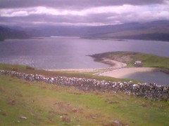
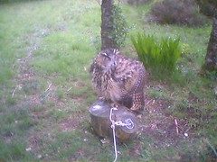
 Day 25 June 4th Kinlochewe
Originally uploaded by rhesus42.
Day 25 June 4th Kinlochewe
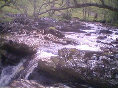
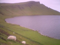
Originally uploaded by rhesus42. 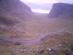 Day 24 June 3rd Applecross
Originally uploaded by rhesus42.
Day 24 June 3rd Applecross
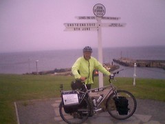
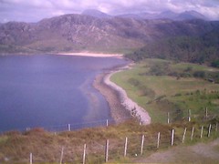
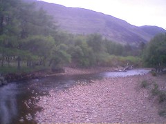
Originally uploaded by rhesus42. 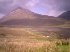 Day 23 June 2nd Broadford
Originally uploaded by rhesus42.
Day 23 June 2nd Broadford
Originally uploaded by rhesus42.